

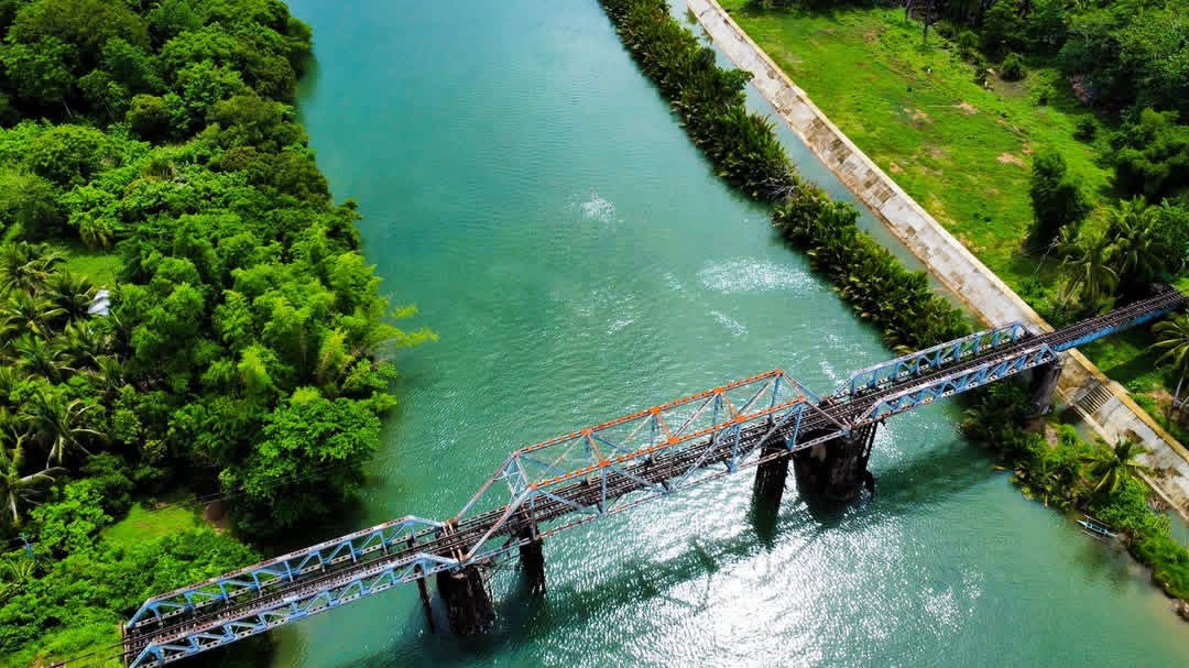
Most travelers passing through Del Gallego treat it as a pit stop on the way deeper into the Bicol Region. That is a mistake. This coastal municipality sits at the northernmost tip of Camarines Sur, bordering the Ragay Gulf to the west, and it holds a quiet kind of beauty that the more famous destinations in the province do not have. No large crowds. No long tourist queues. Just mountains, waterfalls, coastline, and a town that has barely been discovered yet.
If you have time to slow down and look around, Del Gallego will surprise you.
Tabion Hills
Eco-tourism opportunities abound in the hilly interiors, notably at Tabion Hills, where visitors can hike trails amid lush forests and biodiversity hotspots near Mount Isarog National Park, providing serene escapes into the region’s volcanic landscape.
The barangay of Tabion sits quietly in the interior of the municipality. The terrain is rolling and forested, and the trails lead you through areas rich with bird life and native vegetation. It is the kind of hike where the journey itself is the reward. You are not racing toward a single viewpoint. You are moving through a landscape that most people from outside the province have never seen.
If you enjoy trekking without the noise and foot traffic of popular trails, Tabion Hills is worth the effort to reach.
Tabion Falls
Tucked inside Barangay Pamplona, Tabion Falls is one of the natural attractions drawing visitors to this part of Del Gallego. The water is notably clear, which sets it apart from many falls in the region. Local videos and posts describe swimming in its pools as a refreshing and genuinely peaceful experience.
Getting there requires some walking through the surrounding terrain, but the trail is manageable. The falls are not heavily commercialized, which means you are likely to have the place mostly to yourself. That kind of access to a natural waterfall has become increasingly rare in the Philippines.
There is also a smaller companion waterfall nearby, sometimes called Tabion Munti Falls, which visitors often include on the same trip.
Puting Buhangin Beach Resort
Along the Ragay Gulf coastline, Puting Buhangin Beach Resort is known for its white sand and clear waters, offering a tranquil setting for relaxation and swimming. The beach’s charm is enhanced by its remote and untouched quality, making it an exciting spot for adventurers.
This is not a resort in the polished, resort-complex sense. It is a simple, scenic stretch of beach that feels genuinely unhurried. The sunsets along the Ragay Gulf are something local residents talk about, and the beach is calm enough for swimming throughout much of the year. A nearby option, Sta. Rita Island Resort, gives travelers a reason to stay overnight rather than just passing through.
The Old PNR Markers Park
For those interested in Philippine history, Del Gallego holds a landmark that most travelers overlook. The PNR Markers Park is located in Del Gallego, the site where the late President Manuel Luis Quezon drove a golden nail during the inauguration of the North and South Railroad tracks which connected Manila and Legazpi.
That moment marked the completion of a railway line that linked Luzon from end to end. The park commemorates it with markers that tell the story of that era. It is a modest site, but historically significant, and it reflects the town’s long-standing role as a gateway between Luzon and the Bicol Region.
The Gateway Character of the Town Itself
Del Gallego is considered the gateway to the Bicol Region from Metro Manila. Its landscape is characterized by rolling hills and proximity to agricultural lands, with Mount Isarog visible in the distance.
That gateway quality shapes the whole atmosphere of the town. The terrain shifts here. The rice paddies spread out across the lower ground, the hills rise toward the interior, and the coast runs along the western edge. It is a compact mix of environments that rewards travelers who are willing to move slowly and look carefully.
The local cuisine is worth sampling too. Bicol Express and laing, the region’s signature dishes of spiced coconut milk preparations, are widely available, and communal feasts featuring laing, taro leaves cooked in coconut milk and spiced with chili, remain central to local culture and festivals.
When to Visit
The dry season, roughly December through May, offers the most reliable conditions for hiking, swimming, and waterfall visits. The wet season brings heavier rainfall from June onward, which can make trails slippery and rivers more unpredictable. That said, the waterfalls run fuller and the landscape turns a deeper green during the rainy months, which has its own appeal for the right kind of traveler.
Getting There
Del Gallego sits about 287 kilometers from Manila along the Quirino Highway, also called the Andaya Highway. Buses from Cubao or Pasay bound for Naga or points south pass through the town. From Naga, Del Gallego is roughly 109 kilometers to the northwest. Local jeepneys and tricycles handle transport within the municipality and toward the barangays.
Final thoughts
Del Gallego does not try to compete with the Caramoan Peninsula or CamSur Watersports Complex. It does not need to. What it offers is quieter and less curated: real waterfalls, accessible hills, an honest stretch of beach, and a piece of Philippine railway history that most visitors have never heard of.
If you are traveling through Bicol and want to see something that has not already been photographed ten thousand times, stop in Del Gallego. Spend a day. Walk toward Tabion. It will be worth it.